
Hawaii Faces Back-to-Back Tropical Storms as El Niño Breaks the Islands’ Usual Shield
Goldlaner.com – Hawaii has spent decades enjoying a near-mythical immunity from hurricane-scale destruction, a reputation built on cool Pacific waters and punishing upper-level winds that shred storms before they reach the islands. That reputation is under siege right now. For the second consecutive week, a strengthening tropical system is bearing down on the archipelago, and the driver behind the pattern is a powerful El Niño event that has fundamentally rewritten the oceanic and atmospheric conditions around the state.
Moke’s Current Position and Forecast
As of 5 a.m. ET on Saturday, Tropical Storm Moke sat roughly 545 miles southeast of Hilo on the Big Island, packing maximum sustained winds of 45 mph. The system was tracking west-northwest at about 8 miles per hour. Forecasters expect Moke to hold its tropical-storm classification through its passage, with the center projected to pass well south of the Big Island. Even so, the storm’s outer bands are close enough to deliver sustained heavy rainfall and gusty winds onto communities still patching up damage from last week’s visit.
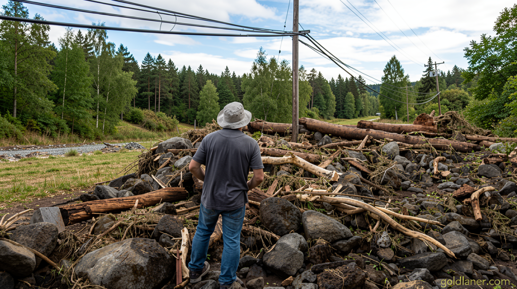
The timing is particularly punishing. Residents on the windward slopes of the Big Island had barely begun clearing debris, repairing roofs, and reconnecting to utilities when Moke’s approach was confirmed. Additional rainfall on saturated ground raises the risk of renewed mudflows and localized flooding, even without a direct center strike.
What Lala Did Last Week
The previous system, Hurricane Lala, intensified while looping just south of the Big Island and unleashed torrential downpours exceeding three feet in places on the island’s windward flank. The result was a cascade of damage: landslides that severed access roads, flash floods that isolated small communities, homes reduced to rubble, and critical infrastructure knocked offline. At least one death has been attributed to the storm’s effects.
Lala’s near-miss kept Hawaii’s remarkable streak of zero hurricane landfalls intact. The last time a hurricane actually made landfall on the islands was Hurricane Iniki in September 1992, a Category 4 storm that struck Kauai from the southwest and leveled large portions of Lihue. More than three decades without a direct landfall made many residents complacent; Lala’s passage served as a blunt reminder that a storm need not touch down to inflict catastrophic harm.
Why El Niño Is the Culprit
In a typical year, the Pacific waters east and southeast of Hawaii — the primary breeding ground for tropical cyclones that later approach the islands — remain relatively cool. When a storm drifts west or northwest toward the archipelago, it encounters progressively colder sea-surface temperatures and a strengthening of hostile upper-level winds. Both factors starve the system of energy and tear it apart, since tropical cyclones draw their fuel from warm ocean and thrive only when the surrounding wind shear is weak.
The developing Super El Niño is dismantling that natural defense on two fronts simultaneously. Sea-surface temperatures to the east and southeast of Hawaii are running well above normal, giving forming storms a richer energy supply. Temperatures to the south are also elevated dramatically. The result is a higher frequency of storms in the Eastern and Central Tropical Pacific, which in turn raises the odds that at least one will track within striking distance of the Hawaiian chain.
The contrast with the Atlantic is instructive. El Niño tends to strengthen upper-level winds over the Atlantic basin, shredding nascent storms before they can organize. That suppressing effect has played out repeatedly this season, with the Atlantic remaining unusually quiet for stretches of weeks. The Pacific, by contrast, is getting a windfall of storm activity precisely where it matters for Hawaii.
Statistical Context and Forecaster Assessment
Even in strong El Niño years, close approaches to the Hawaiian Islands remain statistically rare. Matthew Rosencrans, the lead hurricane season forecaster at the National Weather Service, noted that the typical annual average for tropical cyclones passing within 300 nautical miles of the islands is just one per season. With Moke, Hawaii has already logged twice that figure in a single fortnight, and Rosencrans indicated a third close approach is probable later in the season.
“Very bizarre,” Rosencrans described the two-week window, attributing the unusual clustering to a temporary alignment of atmospheric steering currents that happened to channel storms directly toward the islands.
He cautioned that such alignments are transient. The steering currents could shift in short order, offering the state a reprieve from further close calls. The episode fits a broader El Niño pattern: it raises the probability of certain linked outcomes — more storms forming in the right basin, warmer waters sustaining them longer — without guaranteeing that every individual storm will reach hurricane intensity or make landfall.
What Comes Next
For Hawaii’s residents, the immediate concern is Moke’s rainfall and wind bands over the coming days, layered onto ground already saturated by Lala. Emergency managers on the Big Island and Maui have urged residents to monitor updated forecasts, clear drainage channels, and prepare for possible power outages. The longer-term implication is that the El Niño signal, which typically peaks between December and February, may keep ocean temperatures elevated through the remainder of the 2026 Pacific hurricane season. That means the statistical odds of additional close approaches remain above baseline until the event decays.
The force field is down. Whether it reactivates before the season ends depends on how quickly the El Niño signal weakens and how the steering currents reconfigure. Until then, the islands are exposed in a way most residents have not experienced since the early 1990s.
Related Reading
Frequently Asked Questions
What is Two storms in two weeks?
Two storms in two weeks is the main topic of this guide. The article explains the context, practical details, and next steps readers should understand.
Why does Two storms in two weeks matter?
Two storms in two weeks matters because readers are looking for a useful answer, not just a short summary. Good content should match search intent and help them decide what to do next.